
System could pass near or over Marianas early next week
A weather system developing in the region could reach Guam and the Marianas early next week. Invest 97W has been upgraded to a Tropical Cyclone Formation Alert by the Joint Typhoon Warning Center to a rating of high, meaning tropical cyclone development i
 By KUAM News
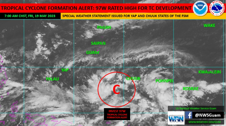
A weather system developing in the region could reach Guam and the Marianas early next week.
Invest 97W has been upgraded to a Tropical Cyclone Formation Alert by the Joint Typhoon Warning Center to a rating of high, meaning tropical cyclone development is likely within the next 24 hours, according to the National Weather Service Guam Weather Forecast Office.
As of 7:30 a.m., it was located about 200 miles south-southeast of Satawal and about 610 miles south-southeast of Guam, near 5 degrees north latitude and 149 degrees east longitude.
The forecast currently favors a track toward the Marianas, with a passage very near or over
some parts of Guam or the CNMI early next week. Through the weekend, clear weather is expected for the Marianas before inclement weather arrives as early as Monday and and continuing through Wednesday, with heavy rainfalls possible.
High uncertainty remains for the exact forecast track and intensity of the system as it approaches
the Marianas. For Guam, it is expected to approach between Monday and Wednesday, with a
potential for a tropical storm to low-end typhoon force impacts. There remains a possibility for
damaging to destructive winds and heavy rains, with increasing potential for hazardous sea
conditions.
The community is advised to take the following preparedness actions between now and this
weekend:
• Those living in flood-prone areas should take action; clear drainage areas and
unblock storm drains to minimize flooding;
• Clear loose debris around your yard and store any items, such as tents and canopies, that
may become airborne with heavy winds, before inclement weather arrives;
• Stay up to date with the latest information. The system track or intensity may change, and
advisories may be issued;
• Locate or prepare your emergency preparedness kits for your household;
• Secure important documents such as birth certificates, tax papers, and insurance
documents, and keep copies in a water-proof bag;
• Gas your vehicles and get fuel for your generators;
• Be prepared to take action if shutters are recommended in the coming day